Updated August 7, 2026 5:23 pm
In short
Google DeepMind says WeatherNext now generates many more hurricane scenarios and will be open-sourced for researchers, while forecasters stress it remains one tool among many in predicting storm impacts.
- WeatherNext can forecast cyclones about a day earlier than current models on average.
- The system helped predict Hurricane Melissa’s path and intensification days in advance.
- Researchers say the model improves both storm track and intensity forecasting.
- Google DeepMind plans to open-source the hurricane-season models.
- Forecasters stress that human expertise remains essential for impact decisions.
Update — August 7, 2026 5:23 pm
Google DeepMind also says WeatherNext is now producing far more storm scenarios than before, expanding from 50 to 1,000 per cyclone. The company says that gives forecasters a much wider range of possible outcomes to weigh as a storm develops.
DeepMind has also decided to open-source the hurricane-season versions of the model, allowing outside researchers to use and improve them. The researchers say that broader access could help uncover new clues about how cyclones form and intensify.
Company and National Hurricane Center officials also stressed that the AI is only one tool in the forecast process. Brennan said human forecasters remain essential because the real challenge is turning storm predictions into impact warnings.
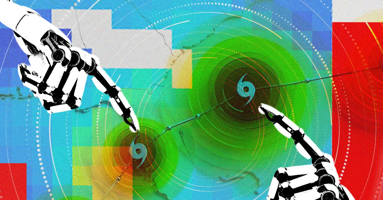
Google DeepMind and Google Research say their WeatherNext system can forecast hurricanes with more lead time than conventional models, a development that could give emergency managers an extra day to prepare before a storm strikes. The breakthrough is already drawing attention after the AI correctly warned that Hurricane Melissa would intensify and hit Jamaica days before landfall.
The new findings, published Thursday in Nature, suggest the model can outperform existing approaches on cyclone forecasting by making predictions three days ahead that are roughly as accurate as older models were two days ahead. For forecasters, that extra margin could translate into earlier evacuations, better supply staging, and more time to protect vulnerable communities.
But the research also raises a broader question that meteorologists and AI scientists are now confronting: how far can machine learning push weather forecasting, especially for rare and destructive events such as major hurricanes? DeepMind’s answer is that the model’s value lies not just in speed, but in the way it combines large-scale weather information with storm-specific patterns to improve both track and intensity forecasts.
What did Google DeepMind’s AI get right about Hurricane Melissa?
It predicted the storm’s likely path and strengthening several days before landfall, helping forecasters raise alarms earlier than traditional methods alone would have allowed. In October 2025, as a storm system formed over the Caribbean, WeatherNext favored a Jamaica strike and projected a severe intensification pattern when other models still showed significant uncertainty.
According to the researchers, the system estimated five days in advance that the storm would hit Jamaica as a Category 5 hurricane with 80 percent confidence. Hurricane Melissa later became a devastating storm, bringing flooding and landslides across Jamaica and becoming the first time the US National Hurricane Center was able to forecast a Category 5 event while the storm was still only a Category 1 system.
That timing mattered. Even when forecasts do not eliminate risk, earlier certainty can improve decisions about where to send supplies, when to begin evacuations, and how to prepare emergency crews. The core advantage, supporters of the model argue, is not dramatic new language from an AI lab, but more time for officials to act on existing warnings.
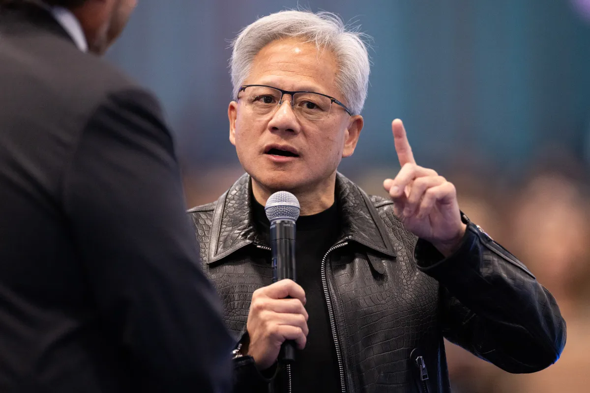
“Even a few hours can make a difference,” said Mike Brennan, director of the US National Hurricane Center, adding that the extra forecast day is valuable because disaster-response decisions are tightly time-dependent and mistakes can have severe consequences.
Why does one extra day matter so much in hurricane forecasting?
One extra day matters because hurricane response is a race against logistics, uncertainty and public compliance. The earlier authorities know where a storm may strike and how strong it may become, the sooner they can open shelters, move emergency equipment, pre-position medical teams and communicate risk to residents who may need to leave.
Meteorologists say the difference between a three-day and a four-day window is not simply numerical. It can determine whether a hospital has enough time to move patients, whether ports can secure equipment, and whether families can reach safety before roads become impassable. That is especially critical in fast-intensifying storms, where conditions can deteriorate overnight.
The National Hurricane Center’s Brennan noted that forecasting is not just about the track of a storm. It is about translating uncertainty into action. A wind field, rainfall estimate and surge forecast all shape the eventual impact, and those impacts—not just the storm’s centerline—are what often determine how many people are harmed.
How does WeatherNext differ from traditional hurricane models?
WeatherNext is designed to blend broad weather patterns with cyclone-specific signals in a way that traditional numerical models do not easily replicate. The DeepMind team says it trained the system to be good at general weather forecasting while also learning from the limited historical record of cyclones.
That matters because hurricanes are relatively rare compared with day-to-day weather. Machine-learning systems usually thrive when there is a large quantity of labeled examples, but severe cyclones do not offer the same abundance of training data. DeepMind’s researchers say they addressed this by training on weather at large and then teaching the system to recognize storm behavior within that wider context.
Ferran Alet, a research scientist at Google DeepMind and one of the paper’s lead authors, said the scarcity of cyclone examples forced the team to think differently about the problem.
Alet said the team’s approach was to build a model that could learn from the much larger body of weather data while also becoming specifically useful for cyclones, where examples are far fewer.
The key technical twist is resolution. Traditional hurricane intensity forecasts often rely on highly detailed local data, while WeatherNext appears to extract useful signals from lower-resolution atmospheric inputs that would normally be considered too coarse for such precise work.
Why is storm intensity harder to forecast than the track?
Storm intensity is harder to forecast because it depends on smaller-scale processes that are harder to capture in global weather grids. The track of a hurricane is influenced by broad atmospheric steering currents, cold fronts and large wind patterns. Intensity, however, depends on fine-scale interactions near the storm’s core and over the ocean surface.
Kate Musgrave, tropical cyclone group lead at the Cooperative Institute for Research in the Atmosphere and an author on the paper, said earlier AI tools had done reasonably well on track prediction but struggled badly with intensity. She explained that global models often miss the local ocean and atmospheric details needed to tell whether a storm will strengthen rapidly or remain relatively weak.
That distinction is crucial. A storm that shifts from tropical-storm strength to Category 4 or Category 5 in a short period can catch communities off guard, change the evacuation footprint and alter how much time responders have to prepare. Rapid intensification remains one of the most dangerous challenges in hurricane science.
How accurate is the new model compared with existing systems?
The researchers say WeatherNext gives forecasters about a full day more lead time on average than current models. In practical terms, predictions made three days out are roughly as reliable as older models’ predictions two days out. In the forecasting world, that is a major step.
DeepMind and its collaborators tested the model retrospectively before using it in live forecasting, and the results appeared so strong that even some of the scientists involved were initially skeptical. According to Musgrave, the retrospective performance was so good that the team did not assume it would necessarily hold up once the system was used in real time.
Instead, it did. Once forecasters began incorporating WeatherNext into operations, the gains remained visible, surprising some of the researchers who had been cautious about reading too much into benchmark results.
The promise is especially notable because historical progress in hurricane prediction is usually slow. The paper says adding a day of useful forecast lead time would traditionally require years of incremental work, sometimes stretching over a decade.
| Forecast element | Traditional models | WeatherNext AI | Operational value |
|---|---|---|---|
| Lead time | Baseline | About one extra day | More time for evacuations and staging |
| Track prediction | Strong at broad motion | Comparable or better at longer range | Earlier landfall warnings |
| Intensity prediction | Often limited | Improved, including rapid strengthening | Better planning for high-end storms |
| Scenario generation | Constrained by compute | 1,000 scenarios per storm | Better representation of uncertainty |
What did scientists learn from the model’s surprising results?
One of the most intriguing findings is that the model seems to uncover useful patterns in coarse weather data that conventional wisdom assumed would be insufficient for detailed cyclone forecasting. That has made the system interesting not only to forecasters, but also to scientists who study the physics of storms.
DeepMind researchers say they do not fully understand why the model can infer intensity so well from lower-resolution inputs. In other words, the AI is extracting information that human designers have not yet been able to explain clearly.
That opacity is a familiar feature of modern machine learning systems. The model may not offer a simple physical explanation, but it does appear to produce usable predictions. For researchers, that combination is both frustrating and exciting: frustrating because the mechanism is unclear, and exciting because it may reveal weather relationships that have been underestimated or overlooked.
Alet described the system as a black box in practical terms, but said its strong performance gives physicists a clue that something important is being captured in the data that earlier methods did not fully recognize.
What is the role of uncertainty in the new system?
The role of uncertainty is central, because the model does not provide just one forecast path. It produces a wide range of possible storm futures, allowing forecasters to assess how the system could evolve if small initial conditions shift. That approach is designed to reflect the “butterfly effect” that is especially important in weather.
DeepMind says WeatherNext now generates 1,000 scenarios for each storm, up from 50 the previous year. That increase gives meteorologists a much richer view of uncertainty, and it is particularly helpful when a storm is near a threshold where slight changes could determine whether it fizzles or becomes catastrophic.
Musgrave said that volume of simulations would be impossible to match with current numerical models using the computing resources available to forecasters. In practice, this makes the AI system valuable not as a replacement for other forecasts, but as one more lens through which to assess risk.
How will forecasters use WeatherNext in practice?
They will use it as part of a broader forecasting toolkit rather than as a standalone oracle. Brennan emphasized that no single model is guaranteed to be best every season or for every storm, no matter how well it performed in a recent case study.
That caution reflects the reality of operational meteorology. Forecast centers compare multiple models, weigh historical performance and incorporate human judgment. AI outputs can sharpen the picture, but they do not remove uncertainty. Expert forecasters still decide how to interpret track shifts, intensity changes and possible impacts on communities.
In that sense, the new model is more about expanding options than replacing people. It may help narrow possibilities earlier, but the final task of converting model output into public guidance remains a human responsibility.
Brennan said the model is a strong addition to the forecasting toolbox, but he stressed that people still have to interpret what the storm will actually do and what that means for those in its path.
Why human expertise still matters
Human experts matter because impact forecasting requires local context. A track line on a map does not say whether a neighborhood will flood, whether roads will wash out, or whether power grids will fail. Those decisions depend on terrain, infrastructure, evacuation routes and social vulnerability.
That is why hurricane forecasting is not only a scientific problem but also a communication problem. Even the best model has limited value if warnings are not translated into action that residents trust and understand.
- Model output needs local interpretation.
- Emergency plans depend on the timing of decisions.
- Public warnings must account for risk, uncertainty and trust.
- Impact, not just trajectory, determines harm.
Why is Google open-sourcing the hurricane models?
Google DeepMind says it plans to open-source the WeatherNext models used during hurricane season so that outside researchers can test, improve and build on them. That move could broaden scientific participation and help independent teams evaluate whether the model’s strengths are reproducible in other settings.
Open-sourcing also matters because the most interesting questions may not be operational but scientific. If the model is detecting subtle signals in coarse weather data, outside researchers may be able to probe those patterns, compare them with other methods and identify what the system is learning about cyclones that humans previously missed.
Alet said he is enthusiastic about that possibility because wider access could help deepen understanding of storm formation. The hope is not merely to produce a better forecast tool, but to improve the science behind cyclone prediction itself.
Alet said he sees AI as a way to help scientists explore the underlying rules of nature more effectively, especially when the model surfaces patterns that are not yet fully understood.
Timeline: From retrospective tests to live hurricane forecasts
The model’s development story shows how quickly AI weather forecasting is moving from promise to deployment. Below is a simplified timeline of the key milestones described by the researchers.
| Date/period | Development | Why it mattered |
|---|---|---|
| October 2025 | WeatherNext flagged a major Jamaica strike days before Hurricane Melissa made landfall | Demonstrated early real-world usefulness |
| Before live use | Researchers ran retrospective tests on historical storm data | Showed strong benchmark performance |
| Operational rollout | Forecasters began using the model in practice | Confirmed the gains held up in live conditions |
| Thursday publication | Results appeared in Nature | Provided peer-reviewed scientific validation |
| Open-source release | Google announced plans to share the hurricane-season model | Could accelerate outside research and development |
What does this mean for the future of weather prediction?
It suggests AI may begin shifting weather forecasting from a race for small gains to a broader restructuring of how predictions are made. If a machine-learning model can reliably extend lead time without sacrificing accuracy, it could change how forecast centers think about storm preparation windows, model ensembles and uncertainty estimation.
That does not mean traditional physics-based models are obsolete. Those systems remain foundational to meteorology and help explain how the atmosphere works. But AI tools like WeatherNext may increasingly fill gaps where classical models are expensive, slow or less precise, especially when the key question is not just where a storm will go, but how quickly it will intensify.
The potential scientific payoff is also significant. A model that performs better than expected can become a hypothesis generator, pointing researchers toward atmospheric relationships worth studying more closely. Even if some of its internal logic remains obscure, its output can still guide new experiments and challenge long-held assumptions.
The bigger picture: AI, disasters and public safety
Weather forecasting is one of the clearest examples of AI’s public-safety promise because the benefits are measurable and immediate. More accurate forecasts can reduce panic, improve coordination and potentially save lives. In the case of hurricanes, where the cost of hesitation is high, the value of even modest gains can be enormous.
At the same time, the DeepMind story is a reminder that impressive model performance does not eliminate the need for judgment. Forecasts are only useful if they are communicated effectively, trusted by the public and embedded in emergency systems that can actually respond.
That is why this advance is important beyond the technical milestone. It shows that AI is beginning to contribute not just to digital products or productivity tools, but to one of the oldest and most consequential challenges in science: understanding and anticipating the forces of nature before they turn deadly.
For now, WeatherNext is not a substitute for meteorologists. It is a more capable assistant than many forecasters have had before, one that may offer an extra day to act when a storm is still far from shore. In hurricane season, that can be the difference between readiness and regret.
Frequently asked questions
What is Google DeepMind’s WeatherNext model?
WeatherNext is an AI weather forecasting model from Google DeepMind and Google Research. It is designed to predict storm behavior, including hurricane track and intensity, by learning from large-scale weather data and cyclone patterns.
How much earlier can the hurricane AI forecast storms?
The model can give forecasters about one extra day of lead time on average. DeepMind says its three-day forecasts are roughly as accurate as older models’ two-day forecasts, which can be crucial during hurricane emergencies.
Did WeatherNext predict Hurricane Melissa correctly?
Yes. The system identified that the storm would likely strengthen and strike Jamaica several days before landfall, giving forecasters earlier warning. Researchers say that helped improve preparation for the destructive hurricane.
Will Google share the WeatherNext model publicly?
Yes. Google DeepMind says it will open-source the WeatherNext models used during hurricane season so researchers can study, test and improve them. The company hopes this will also reveal new scientific insights about cyclones.
Does the AI replace human hurricane forecasters?
No. Experts say the model is a valuable addition to the forecasting toolbox, but human forecasters are still needed to interpret the data and translate it into evacuation, shelter and impact decisions.